


Jump to: Historic Missions Trails | Urban River & Park Trails | Shaded Nature & Greenway Trails
Whether you are looking for a relaxing Sunday walk in San Antonio or eager to explore historic paths winding past UNESCO World Heritage sites, the Alamo City offers an incredible variety of footpaths.
From paved, flat riverside walks to quiet nature preserves tucked deep within suburban pockets, there are San Antonio walking trails suited for every stride.
Editor’s Note: We work hard to provide you with accurate, updated information. However, all details are subject to change. Please verify information before heading out. This post may contain affiliate links.
If you click and make a purchase, we may earn a small commission at no extra cost to you. We only recommend experiences we truly believe in!
Curious about how we choose our content? Here’s our process.
Also check out these articles – Best Family Attractions in San Antonio, Waterfalls in Texas, and Best Backpacking Trails in Texas.
Best Historic San Antonio Walking Trails Along the Missions
Mission Concepción Trail
Walking the Mission Reach here puts you right in front of the oldest unrestored stone church in the country, the Mission Concepción. It was built between 1740 and 1755, and much of it still looks as it did when it was completed. Its 45-inch-thick walls, vaulted roof, dome, and weathered limestone facade make an impressive first stop, but you’ll also want to step inside.
Mission Concepción has the greatest concentration of original wall art remaining in San Antonio Missions National Historical Park. A 2010 conservation effort revealed original frescoes in the sanctuary and nave, including the striking “Eye of God” fresco on the convento ceiling.
Outside, the paved trail follows the river, with interpretive signs and shaded benches. It also connects directly to the broader Mission Reach, so you can easily turn this into a longer outing if you’re looking for San Antonio walking trails that combine history with time outdoors.
When: Daily: Sunrise to sunset
Where: Mission Concepcion, 807 Mission Rd, San Antonio, TX 78210
How Much: Free
Mission San José Trail
Mission San José has been called the “queen of the missions,” a nickname first given by a visitor in 1777 for its sheer scale and build. It’s said to be the largest of San Antonio’s missions, and the complex was almost fully restored to its original design in the 1930s
Restored defensive walls surround living quarters, a granary, gristmill, and workshops, giving you a remarkably tangible look at how a fully functioning colonial community operated.
The showstopper is the Rose Window on the south wall of the sacristy. Pedro Huizar, a Spanish carpenter and surveyor, is credited with carving it, and it’s considered one of the finest examples of Spanish Colonial ornamentation in the United States.
Inside, you’ll also find a remarkable wooden stairway: all 25 steps leading to the choir loft and bell tower were hand-carved from a single live-oak log, without nails or pegs.
The trail connects directly to the Mission Reach hike-and-bike path, making Mission San José an easy starting point if you want to explore more of the SA Missions trail.
Stop by the Visitor Center for a free trail map before heading south toward Mission San Juan and Mission Espada, especially if you’re planning to make a full day of exploring the corridor.
When: Daily: Sunrise to sunset
Where: Mission San Jose Trail, San Antonio, TX 78214
How Much: Free
Mission San Juan to Mission Espada Trail
If you want a quieter stretch of the SA Missions trail, head south from Mission San Juan toward Mission Espada. This is the most peaceful section of the Mission Reach, with farmland, open sky, and the river creating a much more relaxed backdrop as you move between the two missions.
Not long after crossing the Mission Road bridge, you’ll spot the Espada Acequia on your right. Hand-dug in the 1730s, this canal carried water from the Espada Dam to the farms at Mission Espada and remains the only continuously operated acequia system in Texas.
Be sure to take the short detour to the Espada Aqueduct, about a third of a mile from Mission Road. The aqueduct is the oldest operating aqueduct in the United States, and a terraced park around it lets you get a closer look at the masonry.
The trail is 3.2 miles one way, paved, and mostly flat, with pedestrian bridges carrying you across the river along the way.
When: Daily: Sunrise to sunset
Where: Mission Espada Trail, San Antonio, TX 78214
How Much: Free
Scenic San Antonio Walking Trails in Urban Parks & River Reaches
San Antonio River Walk – Museum Reach

Image credit: The San Antonio River Walk
If you’ve done the busy downtown stretch of the River Walk, head north and you’ll get a quieter experience on the Museum Reach.
This 3.5-mile, fully paved extension runs toward the Pearl, surrounded by more than 70,000 native plants, water features, and an ever-changing collection of public art.
You’ll pass the San Antonio Museum of Art, Tobin Center for the Performing Arts, and unexpected pieces like Donald Lipski’s giant fish sculpture hanging beneath I-35 and Carlos Cortés’ Grotto near the Camden and Newell Street Bridges.
Keep an eye out for the Brooklyn Avenue Lock and Dam, too. The system raises and lowers river barges by about nine feet as they travel between downtown and the Pearl.
From April through October, you may also catch roughly 60,000 Mexican free-tailed bats emerging from beneath the I-35 bridge around sunset. If you visit in December, come after dark to see the Museum Reach transformed into the River of Lights, with thousands of LEDs illuminating the trees, bridges, and even sections beneath the water.
The route eventually brings you to the Pearl, where you can finish your walk with restaurants, shops, and the Sunday farmers market.
When: Daily: Open 24/7
Where: Museum Reach – San Antonio River Walk, San Antonio, TX 78215
How Much: Free
Brackenridge Park Trails

Image credit: Brackenridge Park Conservancy
With 343 acres of greenery just north of downtown, Brackenridge Park gives you plenty of room to trade city streets for tree-lined trails without actually leaving San Antonio.
Three named routes, the 1.5-mile Waterworks Trail, 1-mile Wildlife Trail, and 0.75-mile Wilderness Trail, wind through native groves and along the San Antonio River, with public art from artists including Carlos Cortés, Susan Budge, and Anne Wallace appearing along the way.
For wildlife, make the Wildlife Trail your pick. You can spot herons fishing in the shallows, turtles sunning themselves on logs, and ducks, swans, and egrets moving through the river.
Prefer your walk a little more secluded? The Wilderness Trail has the densest tree cover of the three, giving you a cool, shaded route.
Brackenridge also makes a great jumping-off point if you want to build a longer outing. Park near the Japanese Tea Garden and you can easily work in the Tea Garden’s waterfall and koi pond loop before exploring the park’s trails.
The broader network also connects to the San Antonio River Walk Hike & Bike Path, which continues south toward the missions.
When: Daily: 5 am – 11 pm
Where: Brackenridge Park, 3700 N St Mary’s St, San Antonio, TX 78209
How Much: Free
Woodlawn Lake Park Trail
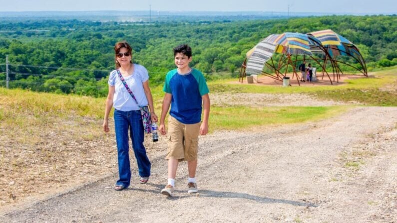
Image credit: City of San Antonio – Municipal Government
If you just want a good, easy loop with something interesting to look at, Woodlawn Lake is the place to go. It features a flat, 1.4-mile concrete path circling a 30-acre lake, where you can catch views of the San Antonio skyline across the water, including the Tower of the Americas, Frost Bank Tower, and Tower Life Building.
There’s even a small lighthouse sitting in the middle of the lake.
Keep an eye on the water, too. Black-bellied whistling ducks, geese, and turtles are regular visitors, and many are comfortable enough around people to come right up to the shoreline.
On Sunday mornings, you might even see members of the Woodlawn Lake Sailing Club steering remote-controlled boats around the shallow end near the fishing pier.
High-visibility lighting makes the path comfortable for early-morning or evening walks, but there’s little shade on the loop itself, so bring sun protection in the warmer months.
Dogs are welcome, and restrooms and water fountains are conveniently located near the playground and tennis courts.
When: Daily: 5 am – 12 am
Where: Woodlawn Lake Park Trail, San Antonio, TX 78201
How Much: Free
Denman Estate Park Trail
Tucked near the Medical Center, Denman Estate Park is somewhat overlooked but worth seeking out. The 21-acre property has roughly half a mile of gravel and paved paths looping around a pond framed by cypress and live oak trees.
Deer, ducks, turtles, and white-winged doves regularly pass through.
The main attraction is the Pavilion of Gwangju, a traditional Korean pagoda perched beside the pond. Craftsmen and artists traveled from Gwangju, South Korea, San Antonio’s sister city, to build it on-site in 2010.
Its distinctive upturned roof corners reflect the pavilion style of South Korea’s southern provinces, while the reflection in the pond makes for one of the park’s most photogenic views.
There’s more to explore beyond the pond, including the Moon Labyrinth, a low-hedged spiral walkway designed for meditation and prayer, and the original 1936 Denman mansion, now used as a retreat and event venue.
Go on a weekday if you want the quietest experience.
When: Daily: 7 am – 9 pm
Where: Denman Estate Park Trail, San Antonio, TX 78229
How Much: Free
Shaded Nature & Greenway Walking Trails in San Antonio
Friedrich Wilderness Park
If you want to trade the city for Hill Country terrain, Friedrich Wilderness Park is one of the best places to do it. The 600-acre park sits along the Balcones Escarpment, where San Antonio’s flatter terrain gives way to the hills.
More than 10 miles of paved and natural paths wind through steep hills, deep canyons, and dense woodland, creating a much wilder experience than you might expect this close to the city.
The park is also a major draw for birdwatchers, with two federally endangered songbirds, the Golden-cheeked Warbler and Black-capped Vireo, nesting here. Keep your eyes up as you walk, and you may also spot terrestrial orchids growing along some of the nature trails.
For an easier outing, stick to the Forest Trail or Waterhole Trail, both of which offer a shaded woodland walk without the steepest climbs. If you’re looking for a more demanding hike, the Level 4 routes bring loose rock, boulders, and significant elevation changes.
Parts of the Cedar Flats and Shady Creek trails also feature markers identifying native plants, giving you another reason to slow down and look around.
One thing to know before you go: pets of any kind are prohibited, helping protect the endangered species that depend on this habitat.
When: Daily: 7:30 am – 7 pm
Where: Friedrich Wilderness Park, 21395 Milsa Dr, San Antonio, TX 78256
How Much: Free
Eisenhower Park
The 300-plus-acre Eisenhower Park sits alongside Camp Bullis on the North Side, with about six miles of trails ranging from an accessible paved route to steep, rocky climbs through oak and juniper woodland.
For an easier walk, take the paved Cedar Flats Trail through the center of the park. It’s lined with native-plant identification markers and leads to the observation tower, perched at about 1,280 feet.
Climb to the top, and you’ll be rewarded with 360-degree views stretching across downtown San Antonio and the surrounding Hill Country.
You’ll also have plenty of company from local wildlife, including white-tailed deer, wild turkeys, fox squirrels, and native songbirds.
And if six miles doesn’t sound like enough, Eisenhower gives you access to the Salado Creek and Leon Creek greenways that connect through the park, opening up more than 40 continuous miles of paved trails for a seriously ambitious day outdoors.
Dogs are welcome as long as they stay on leash.
When: Daily, 7 am – 7 pm
Where: Eisenhower Park Trailhead, JCCG+P9, San Antonio, TX 78257
How Much: Free
McAllister Park Trails
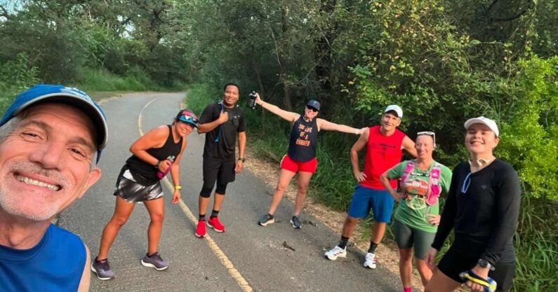
Image credit: San Antonio RoadRunners
McAllister Park is big enough that you can keep coming back and find a different walk every time.
Nearly 1,000 acres of North Side woodland are crossed by more than 15 miles of asphalt and dirt trails, with dense live oak, cedar elm, and juniper providing welcome shade through much of the park.
Keep an eye out for white-tailed deer as you go. They’re a regular sight here, particularly along the quieter inner loops, where you may spot them grazing beside the trail or crossing just ahead of you.
For an easy, family-friendly option, follow the paved Blue Loop, which follows the park’s perimeter on a wide, well-maintained path, with restrooms and playgrounds conveniently located at several points.
If you want something that feels more like a hike, take the Red Trail into the denser woodland. The narrower dirt route has exposed roots, small rocky sections, gentle hills, and seasonal creek crossings. After heavy rain, the dirt trails can become muddy, so sturdy shoes are a good idea.
When: Daily: 5 am – 11 pm
Where: McAllister Park Trails, San Antonio, TX 78247
How Much: Free
Phil Hardberger Park Trails
The Robert L.B. Tobin Land Bridge is the star of Phil Hardberger Park, and once you walk across it, you’ll understand why.
Built across six lanes of Wurzbach Parkway, it reconnects the park’s east and west sections with a landscaped crossing that’s both bridge and hill, depending on how you look at it. Below you, a separate earth berm creates a wildlife corridor where animals can cross away from the pedestrian path.
Once you reach the top, continue onto the Skywalk, a 1,000-foot elevated walkway that rises 18 feet above the ground and brings you right into the tree canopy. Here, you’ll have gorgeous views down into the park’s restored savanna and wetlands.
Two wildlife blinds designed by San Antonio artists are also positioned on the Land Bridge, giving you a sheltered place to watch for deer, foxes, and birds moving through the habitat.
Beyond the Land Bridge, you have 7.5 miles of mostly flat, accessible trails winding through restored savanna, woodland, and wetland habitats. And if you’re not ready to head home, the trails connect to the Salado Creek Greenway, allowing you to turn a short park walk into a much longer adventure.
Parking is free at both the Blanco Road and NW Military Highway entrances, so you can choose whichever side works best for your route.
When: Daily: Sunrise – sunset
Where: Phil Hardberger Park, 8400 NW Military Hwy, San Antonio, TX 78231
How Much: Free
Salado Creek Greenway
If you want to cover some serious ground without giving up the scenery, the Salado Creek Greenway is one of San Antonio’s best bets.
Nearly 30 miles of paved trail follow Salado Creek through the city’s north and east sides. The northern stretch through Eisenhower Park, Phil Hardberger Park, McAllister Park, and Walker Ranch Historic Landmark Park stands out particularly for their scenery.
Limestone bluffs and boulders line the creek, while pecan, live oak, and cedar elm create a shady canopy before the trail opens into the floodplain where turtles, water birds, and deer regularly appear.
One of the most memorable sections is the Morningstar Boardwalk, a 3,400-foot elevated walkway that carries you over a scenic wetland.
You’ll also pass the Voelcker farmstead archaeological site inside Phil Hardberger Park, where historic farm buildings sit among native grasses and heritage oaks.
Start at Eisenhower Park, and you can also connect to the Leon Creek Greenway, opening up more than 50 continuous miles of trails if you’re determined to keep going.
When: Daily: 6 am – 7 pm
Where: Salado Creek Greenway Loop, 3104 N Loop 1604 W, San Antonio, TX 78231
How Much: Free
Leon Creek Greenway
The Leon Creek Greenway gives you 20 miles of paved trail to explore across San Antonio’s west side, but you don’t have to tackle the whole thing to appreciate it.
One of the best stretches runs through a string of connected parks, beginning around O.P. Schnabel Park and continuing through Bamberger Nature Park, Cathedral Rock Park, and beyond.
The broad, mostly flat path follows the creek beneath cottonwoods, heritage oaks, and mountain laurels, with limestone bluffs and wildflower-filled openings adding plenty of variety along the way.
Wildlife is another reason to slow down. Deer regularly cross the trail, while Earl Scott Pond attracts a changing mix of water birds. Near the Ingram Road section, look for the limestone bluff rising above the trees. It creates a natural overlook where you can pause and take in the greenway from above.
You can also extend your walk in either direction, with the trail continuing south toward Pearsall Park and UTSA and north toward Eisenhower Park, where it connects with the Salado Creek Greenway.
When: Daily: Sunrise – sunset
Where: Leon Creek Greenway Park Trail, San Antonio, TX
How Much: Free
Comanche Lookout Park Trails
At 1,340 feet, the Comanche Lookout Park is the fourth-highest point in Bexar County, and the hill was used as a strategic vantage point by the Apache and Comanche peoples long before Nacogdoches Road passed below it.
Historical plaques and public art along the trails help tell that story as you make your way uphill.
Then there’s the tower. Rising four stories above the summit, the medieval-style stone structure was built in the 1920s by a military veteran fascinated by European architecture. At the top, you’re greeted with panoramic views stretching across the San Antonio skyline, including the Tower of the Americas, and toward the Hill Country to the north and west.
Time your visit for sunset, and the view gets even better.
Dogs are welcome, too, with dedicated water fountains and waste stations along the trails.
When: Daily: Sunrise – sunset
Where: Comanche Lookout Park, 15551 Nacogdoches Rd, San Antonio, TX 78247
How Much: Free
O.P. Schnabel Park Trails
Otto Phillip Schnabel was an insurance salesman who returned from a 1947 trip to Switzerland determined to make San Antonio the cleanest city in America. He organized litter campaigns, raised money for downtown trash cans, and rallied residents around the cause until San Antonio won the National Cleanest Town contest four years in a row during the 1950s.
A newspaper columnist eventually nicknamed him “Old Pushbroom.” The park, named in his honor in 1977, continues that legacy with more than eight miles of trails through oak and mountain laurel along Leon Creek.
For an easy walk, stick to the wide, paved loops. If you want more of a hiking experience, head onto the unpaved singletrack, where the trail dips deeper into the wooded creek bottom. Deer are common here, and the dense canopy makes the route feel much more secluded than you might expect.
The park connects directly to the Leon Creek Greenway, so you can easily turn a short stroll into a much longer adventure. You’ll also see limestone outcroppings along the creek and trail edges, remnants of the Balcones Fault Zone running beneath the park.
Dogs are welcome on leash, and water fountains with dog-bowl attachments are available along the trails. Some of the unpaved routes aren’t clearly marked, so grab a map from the trailhead board before heading into the woods.
When: Daily: 5 am – 11 pm
Where: O.P. Schnabel Park, 9606 Bandera Rd, San Antonio, TX 78250
How Much: Free
Know Before You Go: Local Context & Walking Tips
While many of these San Antonio walking trails are located within the urban core and historic loop, the city’s extensive network connects easily across major hubs like Alamo Heights, Helotes, Stone Oak, and the Medical Center.
Most greenway trailheads are within a 15-20 minute drive for residents across the Greater San Antonio metroplex.
Always bring water, especially during warm summer afternoons, and stay on paved paths to protect native habitats.
Frequently Asked Questions About San Antonio Walking Trails
What are the best walking trails in San Antonio?
The top-rated walking trails in San Antonio include the San Antonio Missions Trail for history, the Museum Reach River Walk for urban scenery, and Phil Hardberger Park or Friedrich Wilderness Park for quiet, nature-filled strolls.
How long is the San Antonio Greenway trail system?
The Howard W. Peak Greenway Trail System features over 100 miles of continuously developed, paved multi-use trails encircling the city, including major stretches along Salado Creek and Leon Creek.
What are some hidden gems in San Antonio that are off the beaten path?
Denman Estate Park offers a quiet walking loop surrounding a traditional Korean monument, while Comanche Lookout Park offers quiet hilltop walking paths featuring historic stone masonry away from heavy tourist traffic.
Looking for more? See the upcoming Weekend Events in San Antonio.

- Things To Do This Weekend in San Antonio – October 23 – October 25, 2026 - October 19, 2026
- San Antonio Highlights: October 19 to October 22 – Food, Music, Arts & More - October 18, 2026
- Best Comfort Food San Antonio: Chicken Fried Steak & Stews - October 18, 2026

